


Digital Collections come from a broad range of sources, including materials that are offensive or contain negative stereotypes. VCU Libraries provides access to these items to support research and inquiry.
About this collection
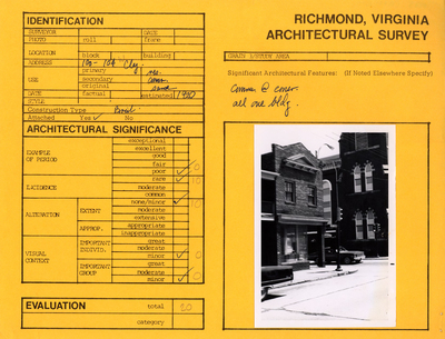
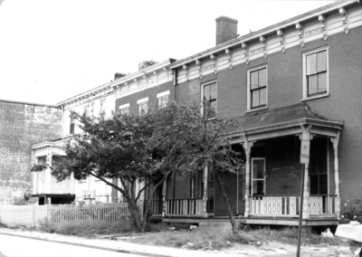
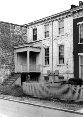
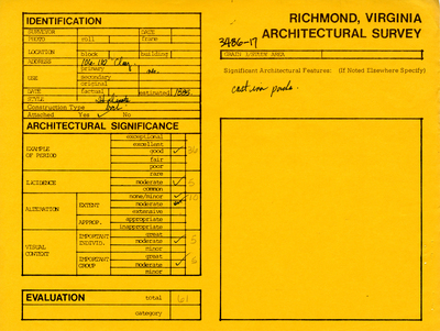
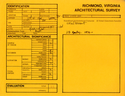
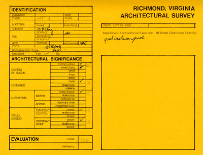
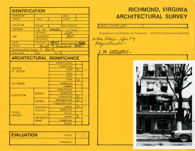
This collection contains data sheets that identify and evaluate over 600 structures located in Richmond’s Jackson Ward and Oregon Hill neighborhoods. The surveys were compiled by the City of Richmond’s Department of Planning and Community Development in the mid-1970s. The evaluations were intended to be used in preservation plans and for city planning as a whole. These data sheets predate the standard survey forms used in Virginia since the 1980s.
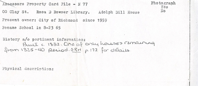
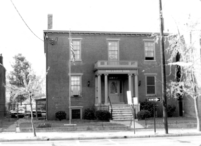
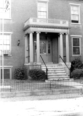
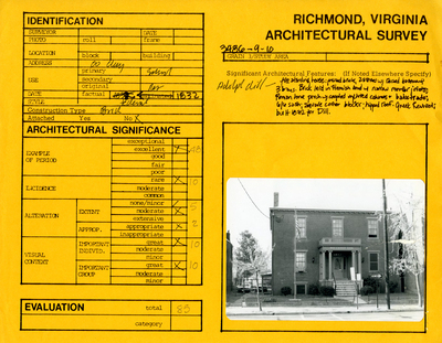
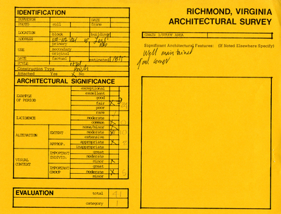
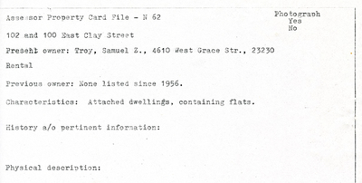
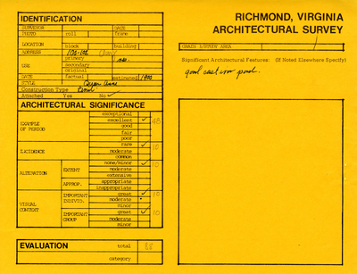
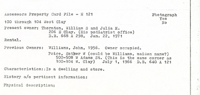
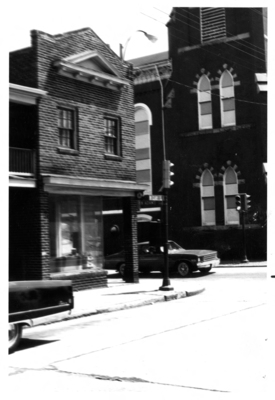
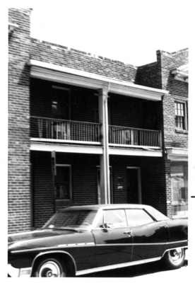
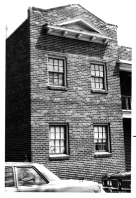
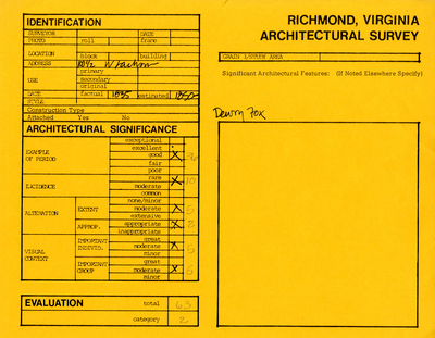
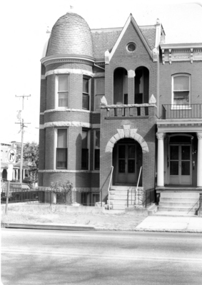
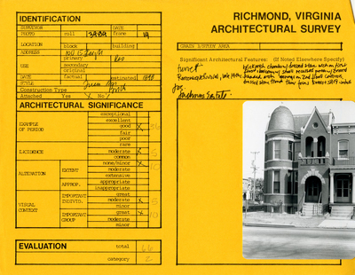
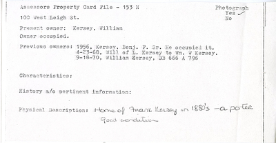
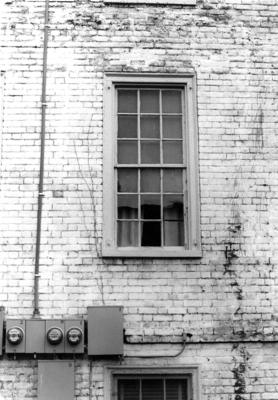
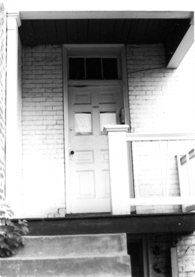
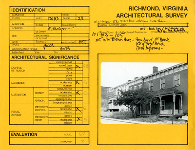
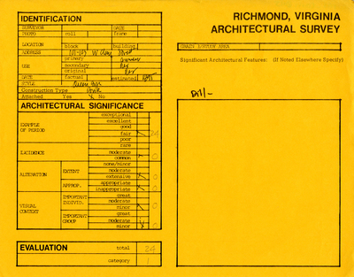
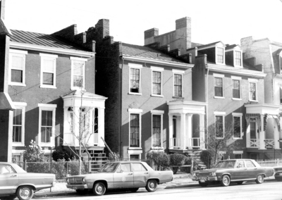
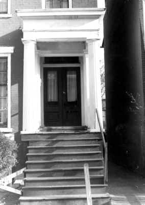
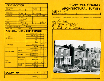
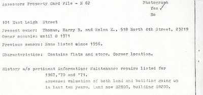
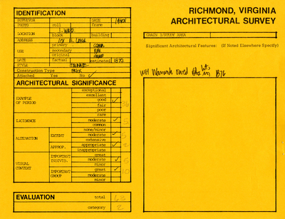
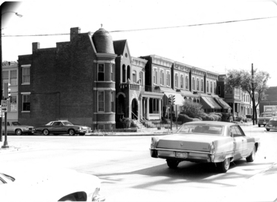
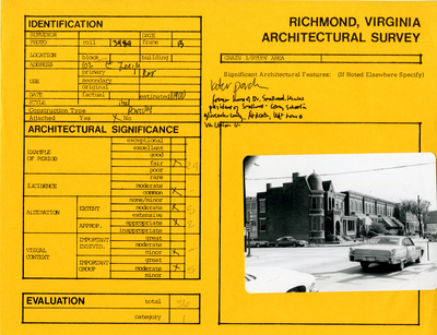
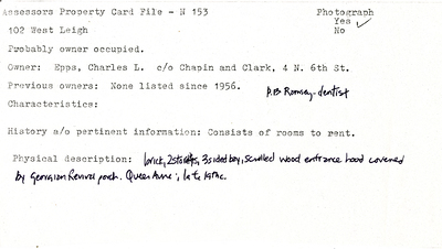
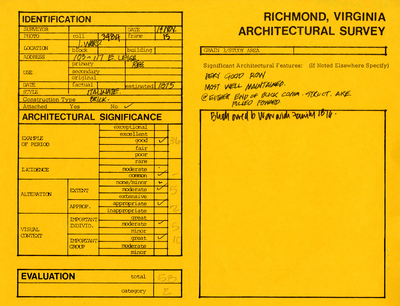
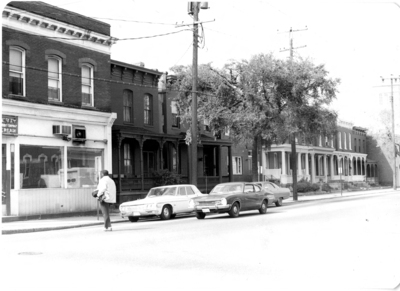
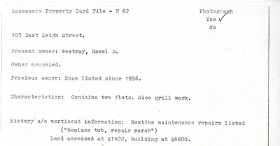
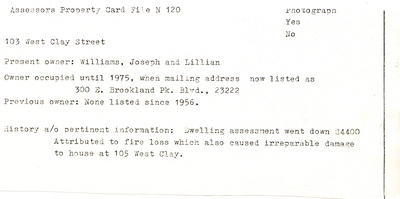
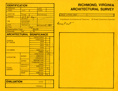
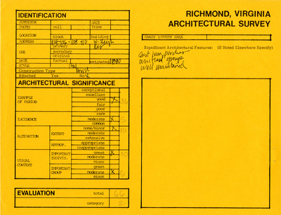
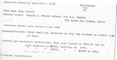
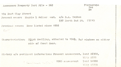
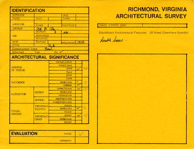
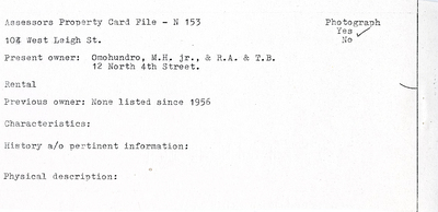
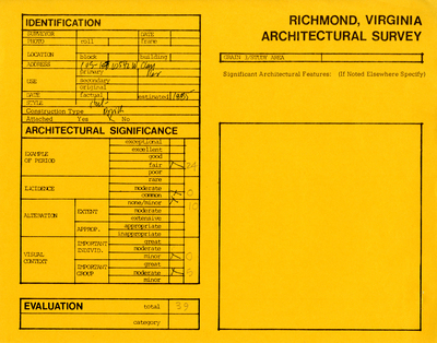
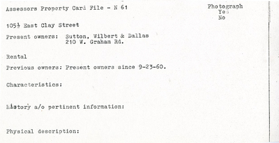
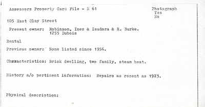
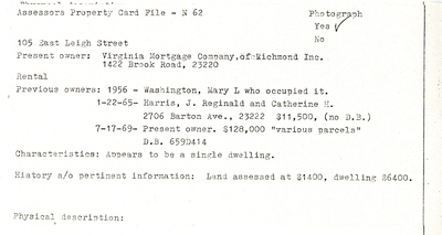
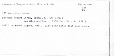
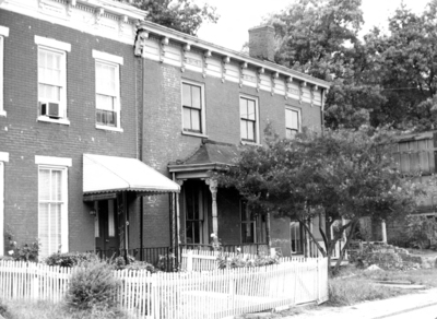
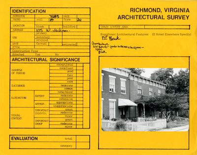
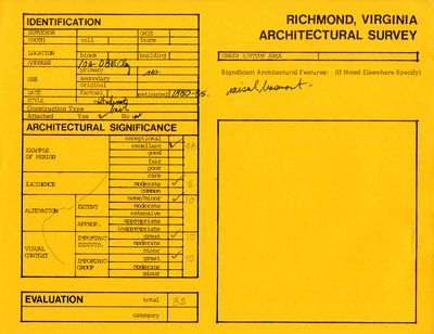
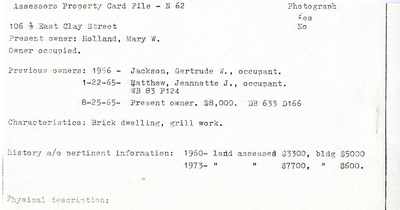
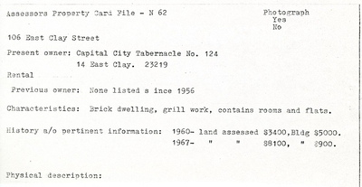
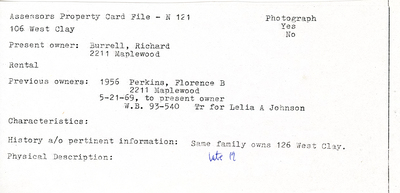
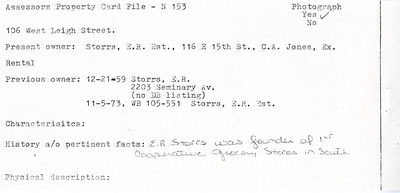
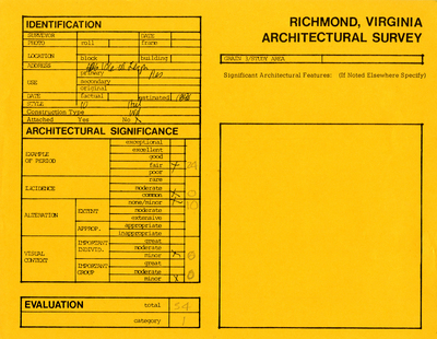
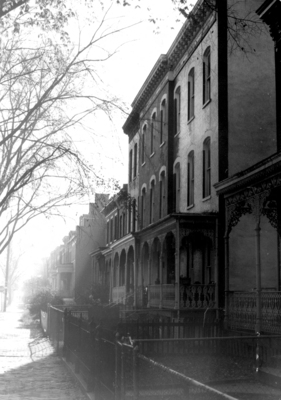
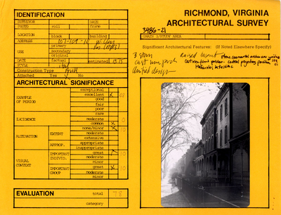
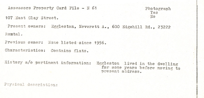
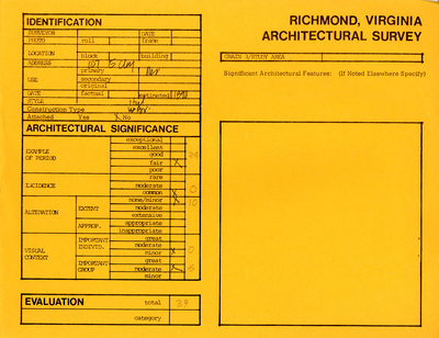
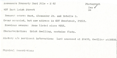
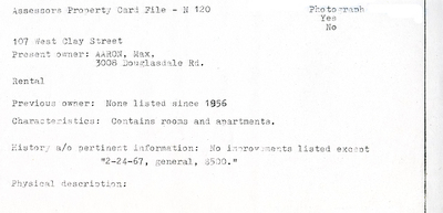
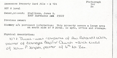
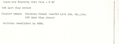
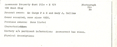
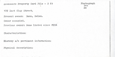
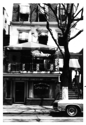
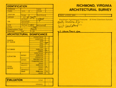
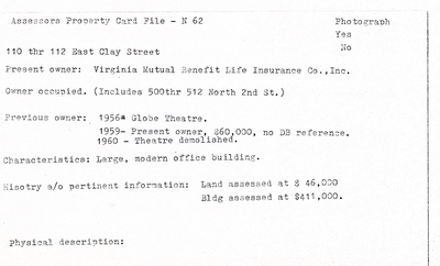
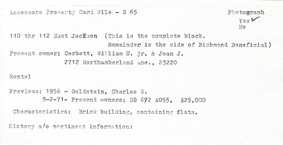
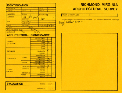
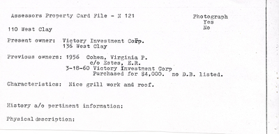
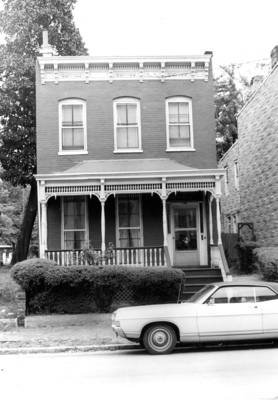
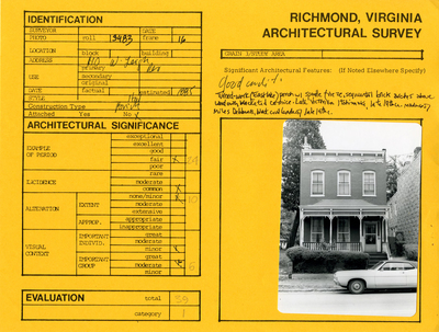
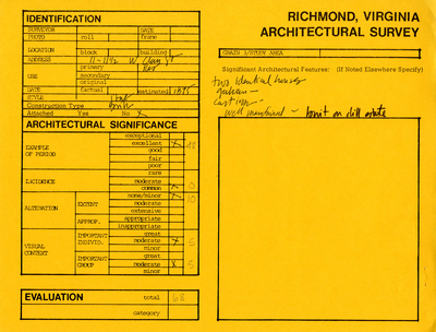
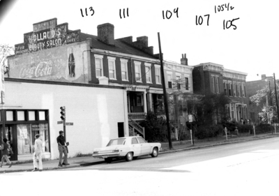
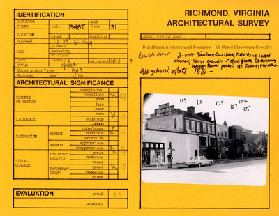
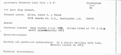
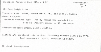
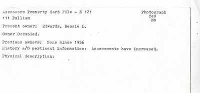
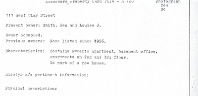
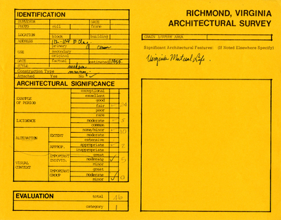
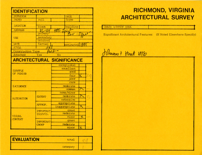
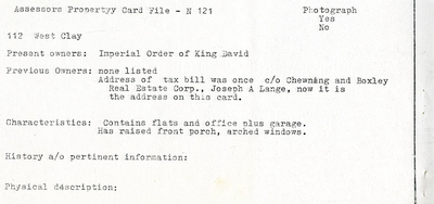
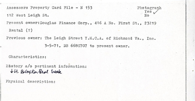
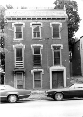
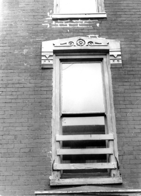
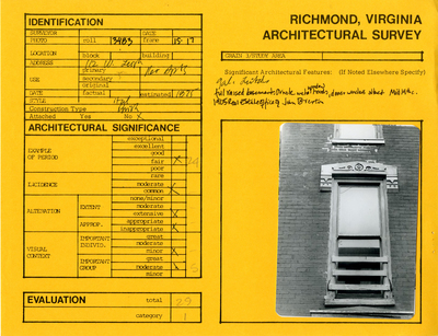
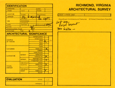
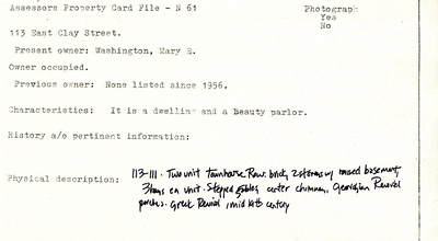
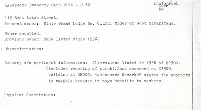
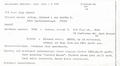
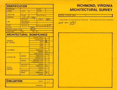
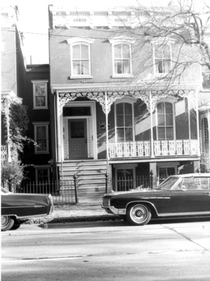
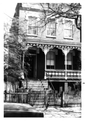
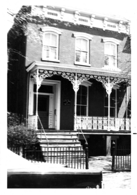
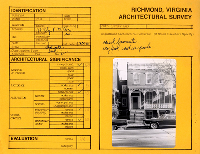
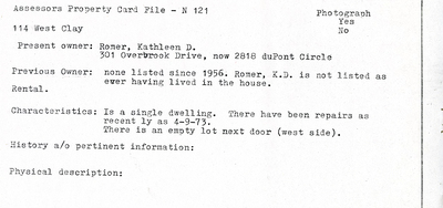
The survey form included a section identifying the building, its basic architecture, and the date of construction. A separate section was used to evaluate the structure’s architectural significance. The forms were color-coded: yellow for Jackson Ward, green for Oregon Hill. Many of them also included one or more photographs of the buildings that were evaluated. In presenting these, we show the original data sheet with the photograph attached, as well as separate images of the photographs themselves. Occasionally, there were also separate Assessors Property Cards included, with further details on the buildings, presented here as separate images.
The data sheets reflect the bias at the time against vernacular architecture. Often, smaller and more simply designed buildings were considered less important architecturally, and less important to preserve. These views began to change in the 1980s when city planners and architectural historians began to consider vernacular architecture as important as other designed buildings. These changing views led preservation efforts to save entire blocks and not just key buildings.
Supplemental Material
Preliminary architectural character overview of the three blocks of Oregon Hill contained by Belvidere, Cumberland, S. Cherry and Cary Street, a 1975 document credited to Wright, Cox, and Smith and the Richmond (Va.). Dept. of Planning and Community Development consists of a two page overview evaluating the architectural significance of a three block area of Oregon Hill. Includes 14 pages of photocopied photographs.
Browse by neighborhood
Jackson Ward
Oregon Hill
The physical collection is housed at James Branch Cabell Library Special Collections and Archives.
Copyright
This material is in the public domain in the United States and thus is free of any copyright restriction. Acknowledgment of Virginia Commonwealth University Libraries as a source is requested.
Credits
VCU Libraries digitized this collection in 2008. Jennifer Cason supervised student employees, digitization, and quality control. Student employees Kaitlin Foray and Kelly Crone assisted with digitization. Metadata Librarian Mary Anne Dyer created the metadata for this digital collection.
. Dept. of Planning and Community Development")
. Dept. of Planning and Community Development")
. Dept. of Planning and Community Development")
. Dept. of Planning and Community Development")
. Dept. of Planning and Community Development")
. Dept. of Planning and Community Development")
. Dept. of Planning and Community Development")
. Dept. of Planning and Community Development")
. Dept. of Planning and Community Development")
. Dept. of Planning and Community Development")
. Dept. of Planning and Community Development")
. Dept. of Planning and Community Development")
. Dept. of Planning and Community Development")
. Dept. of Planning and Community Development")
. Dept. of Planning and Community Development")
. Dept. of Planning and Community Development")
. Dept. of Planning and Community Development")
. Dept. of Planning and Community Development")
. Dept. of Planning and Community Development")
. Dept. of Planning and Community Development")
. Dept. of Planning and Community Development")
. Dept. of Planning and Community Development")
. Dept. of Planning and Community Development")
. Dept. of Planning and Community Development")
. Dept. of Planning and Community Development")
. Dept. of Planning and Community Development")
. Dept. of Planning and Community Development")
. Dept. of Planning and Community Development")
. Dept. of Planning and Community Development")
. Dept. of Planning and Community Development")
. Dept. of Planning and Community Development")
. Dept. of Planning and Community Development")
. Dept. of Planning and Community Development")
. Dept. of Planning and Community Development")
. Dept. of Planning and Community Development")
. Dept. of Planning and Community Development")
. Dept. of Planning and Community Development")
. Dept. of Planning and Community Development")
. Dept. of Planning and Community Development")
. Dept. of Planning and Community Development")
. Dept. of Planning and Community Development")
. Dept. of Planning and Community Development")
. Dept. of Planning and Community Development")
. Dept. of Planning and Community Development")
. Dept. of Planning and Community Development")
. Dept. of Planning and Community Development")
. Dept. of Planning and Community Development")
. Dept. of Planning and Community Development")
. Dept. of Planning and Community Development")
. Dept. of Planning and Community Development")