


Files
Download File (242.3 MB)
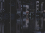
Loading...
Title on Reel (transcribed from original)
8-22-69, Flood Area
Date Created
1969-08-22
Reel Format
16mm
Reel Description
This reel contains footage of flooded areas on the north side of the Mayo Bridge at 14th Street and Dock Street, as well as footage on Main Street at 15th Street.
Timestamp Description
00:00:13 Footage begins. Multiple clips flooded areas in what appears to be downtown Richmond. A overpass with "Seaboard" written on it is visible. The camera looks east on Dock Street.
00:00:32 Panning footage of flooded areas, with individuals including uniformed officers, standing and walking around. Parked cars are also visible.
00:00:39 Footage of what appears to be the Mayo Bridge at 14th Street in Richmond, with sandbags stacked in the distance.
00:00:43 Footage of a street sign which reads "S 14th St" with buildings in the background. The camera pans right to show a flooded street with the "Seaboard" overpass visible. Another signs reads "Watson Cottrell Co. Customer Parking".
00:00:52 Footage of the top of a building which reads "Gordon Metal Company", camera pans down to show mounds of sandbags at the doors of the building and in the road leading to the Mayo Bridge.
00:01:12 Footage of flooding in front of a building at 15th Street and Dock Street.
00:01:25 Footage filmed of the intersection of 14th Street and Dock Street, with trucks and individuals standing in the street. "Watkins-Cottrell Co." is written on the building in the background.
00:01:41 Footage of street signs at an intersection which read "S 15th St" and "E Main St".
00:01:42 Footage of a flooded street. "Dave's Barber Shop" is the only identifiable business.
00:02:26 Two individuals, one in what appears to be a military uniform, stand on a sidewalk.
00:02:29 Multiple clips of flooded streets in downtown Richmond. Several buildings have their windows boarded up.
00:03:17 Footage of several individuals standing in the street, some wear hardhats, some wear military uniforms. Those in uniform appear to carry rifles.
00:03:20 Multiple clips of flooded streets, this appears to be filmed on Main Street. In some clips, the water has receded and left debris on the street.
00:04:01 Footage ends.
Event Description
On August 19, 1969, Hurricane Camille reached Virginia as a tropical depression after making landfall in Mississippi as a category five storm. Referred to as one of the worst natural disasters in Virginia's history, the storm knocked out communication networks, and trapped residents in their homes overnight with floods and landslides. It swept away over 100 bridges in the Commonwealth. In total, 124 individuals died and the storm caused $161 million in damages. In Richmond, the James River severely flooded. In its aftermath, Hurricane Camille led to the passage of the Disaster Relief Act of 1969 (Encyclopedia Virginia).
Runtime
00:04:17
Topical Subject
Hurricane Camille, 1969; Hurricanes; Storm surges; Floods; Natural disasters; Flood control; Flood damage prevention
City/Location
Richmond (Va.)
Genre
color films (visual works)
Local Genre
moving image
Type
Moving Image
Digital Format
video/mp4
Language
eng
Rights Statement URL
Rights
This material is in the public domain in the United States and thus is free of any copyright restriction. Acknowledgement of Virginia Commonwealth University Libraries as a source is requested.
Collection
Richmond Police Department Surveillance Collection
Source
Hurricane Camille Flood Aftermath in Richmond Film Reel #01, 1969 August 22
File Name
VCU_M571_026.mp4