


Preview
Other Title
Illustrated combination atlas of Richmond, Va. 1876
Publisher
F.W. Beers
Creation Date
1876
Description
Published for the Southern and Southwestern Surveying and Pub. Co. by F.W. Beers.
Wards
Clay Ward; Monroe Ward
Physical Description
46 cm.
Topical Subject
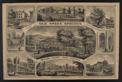
Resorts --West Virginia --Monroe County
Geographical Name Subject
Monroe County (W. Va.)
City/Location
Monroe County (W. Va.)
Temporal
Nineteenth century
Genre
books; maps (documents)
Local Genre
map; text
Type
Still Image; Text
Digital Format
image/jpg
Language
eng
Rights Statement URL
Rights
This material is in the public domain in the United States and thus is free of any copyright restriction. Acknowledgement of Virginia Commonwealth University Libraries as a source is requested.
Original Title
Illustrated atlas of the city of Richmond, Va.
Collection
Illustrated atlas of the city of Richmond, Va.
Source
Beers, F.W. (Frederick W.). 1876. Illustrated atlas of the city of Richmond, Va. Richmond? Va. : F.W. Beers, 1876.
File Name
beers_033.jpg
COinS